Pages: 1 2
- Index »
- Community »
- Debate and Serious Talk »
- Should we still use the mercator projection?!
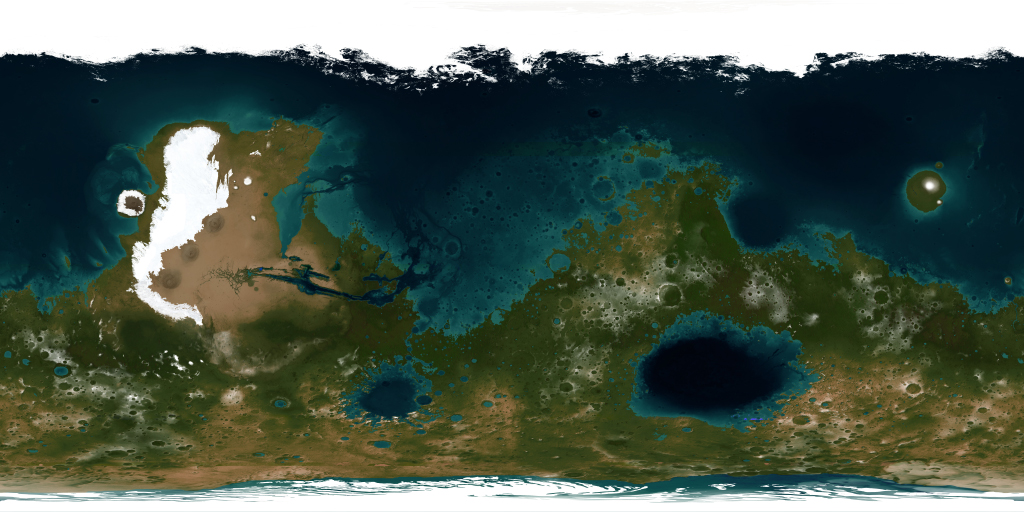
Some more map porn for anybody who is interested. One artist's impression of a terraformed mars, with water:

I'm not sure which projection it uses

I'm not sure which projection it uses
Last edited by BVC (2013-03-18 13:35:42)
If you use a mercator to map the British empire, it looks pretty fucking big. Rule Britannia etc. etc.

The point is that it is subconscious, just like a 6 year old watching the disney channel and then later whining for a new squirt gun. It's done on purpose, of course. Who wouldn't want Europe to look like the size of Africa? Pure cultural bias.KEN-JENNINGS wrote:
I think people are insane if they let the size of their country as shown on a map influence how they feel re: their (and their country's) geopolitical influence.
Change the map to reflect the proper sizes of land masses, that's it.
Sure its bias - no argument from me. But leading to subconsciously view the west as bigger/better? Not really man. I just don't buy it.
By making Europe and Africa appear to be the same size it makes it look like we all had "equality of opportunity" when in fact it was just a bunch of pasty white vikings going around conquering the world
If that makes any sense. Look at the real size of Europe vs. Africa and the kids might start asking, hey, how come the Euros went around everywhere and got such a headstart? "Well, you see Johnny, they killed everyone" Nope, not happening.
If that makes any sense. Look at the real size of Europe vs. Africa and the kids might start asking, hey, how come the Euros went around everywhere and got such a headstart? "Well, you see Johnny, they killed everyone" Nope, not happening.
that's total conjecture. it was never that ideology at all. if anything it was just a small-minded sense that where we came from was the 'centre' or at least took 'centre stage'. you know, like those medieval maps (like the famous mappa mundi, which sits about 15 miles from my house), which all sort of had the ptolemaic conception of whatever territory begot it as it being the 'centre' of the world (christianity and the idea of a kingdom of earth reinforced this, as did the greek view of the med).
if anything, the (subconscious) enlargement of certain territories was probably just to make the empire look bigger/more extensive/more impressive.
if anything, the (subconscious) enlargement of certain territories was probably just to make the empire look bigger/more extensive/more impressive.
I have no doubt that you're correct, but I'm talking about why they haven't changed it, in a modern context. By continuing to make the most unpopulated regions of the world look larger at the expense of the most populated (also mostly 3rd world), we are subconsciously projecting a first world/western bias upon the rest of the Earth. Again, who the fuck cares about Antartica/Alaska?
Last edited by Spearhead (2013-03-18 15:47:40)
It's familiar now, and too much effort to change now. It's similar to why the UK uses a mixture of measuring systems (I imagine).
The ONLY true representation of the world would be on a globe. You can't do it on a 2D surface without having gaps.
The ONLY true representation of the world would be on a globe. You can't do it on a 2D surface without having gaps.


I just learnt that the top of the map used to be to the east, hence orientation.
it wasn't until people started using the north star did they put north at the top.
the more you know (star)
it wasn't until people started using the north star did they put north at the top.
the more you know (star)
Haha true that! Still interesting to look at. I think theres a better one out there, which has used a specialised algorithm to smooth out peaks and fill craters, to account for erosion and other such forces.
Pages: 1 2
- Index »
- Community »
- Debate and Serious Talk »
- Should we still use the mercator projection?!

